Photos
.0IY18_2_e3f2e5b876.jpg) Old Reliable
Old Reliable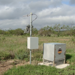 Drought Index Well, on the Dry Devil's River. It has been monitored by sensor since February 2013
.JUKIM_2_23abc43487.jpg) Downloading water level data from an In-Situ sensor.
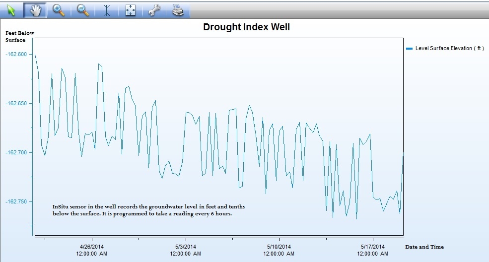
Downloading water level data from an In-Situ sensor.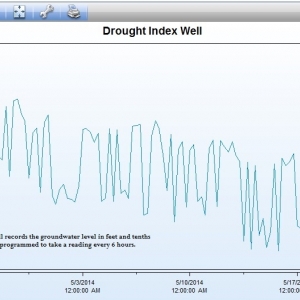 InSitu sensor graph of water level measurements for the Drought Index Well for 4/21-5/21, 2014.
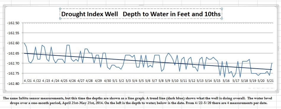
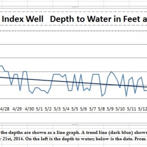 Drought Index Well graph with a trend line added.
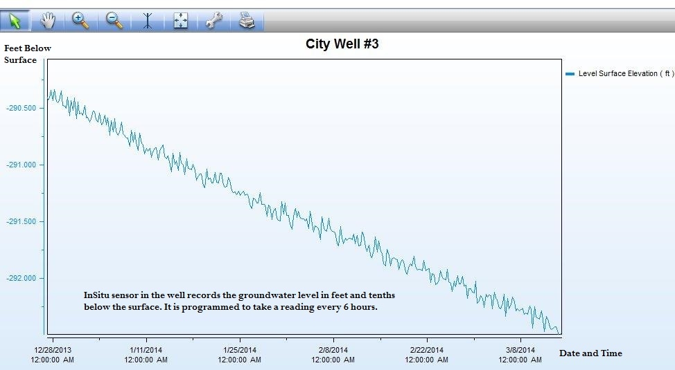
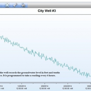 InSitu sensor graph of measurements from City Well #3 for 12/28/2013-3/15/2014.
.YSCME_2_2436f53e9b.jpg) Checking the water level with an E-Line (electric) device
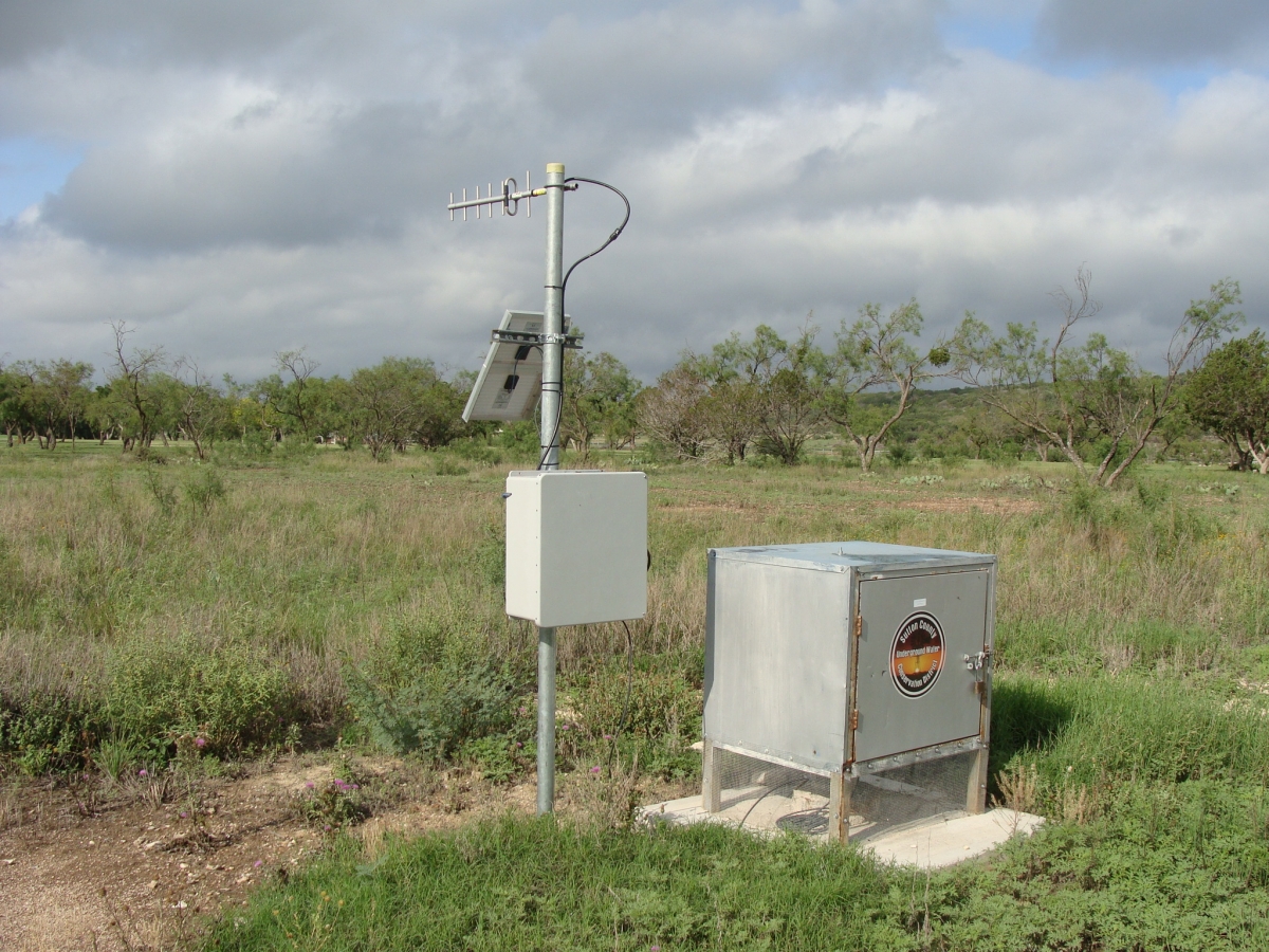
Checking the water level with an E-Line (electric) device.N64PI_2_f005b61f7b.jpg) TWDB Monitored Well via Telemetry, Brockman Ranch
TWDB Monitored Well via Telemetry, Brockman Ranch.IL0SY_2_becef058f5.jpg) Downloading data from an automatic rain guage.
Downloading data from an automatic rain guage..76NXJ_2_2618a17f43.jpg) Setting up to video record a well on the Ross ranch
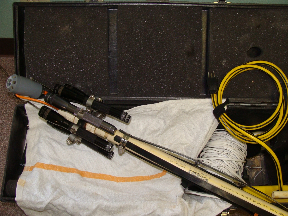
Setting up to video record a well on the Ross ranch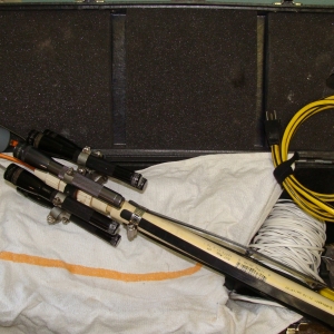 Downhole camera, partially assembled, lying in open case.
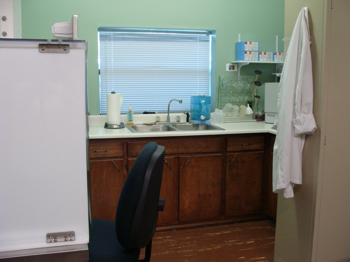
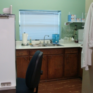 Water District Laboratory at the office in Sonora.
.0IY18_2.jpg)
.JUKIM_2.jpg)
.YSCME_2.jpg)
.N64PI_2.jpg)
.IL0SY_2.jpg)
.76NXJ_2.jpg)